Surveyor Topographer carries out hundreds of topographical surveys every year — for homeowners, architects, developers and local authorities across the UK. And yet a surprising number of our clients tell us the same thing when they first get in touch: "I know I need a topographical survey, but I'm not entirely sure what one is." This guide fixes that — completely.
Whether you're a homeowner planning an extension, an architect starting a new project, a developer assessing site feasibility or a planning consultant preparing an application, this plain-English guide will give you everything you need to understand what a topographical survey is, what it involves, and why it matters.
In This Guide
- What is a topographical survey?
- What does a topographical survey include?
- Why do you need a topographical survey?
- Who needs a topographical survey?
- How does it differ from other survey types?
- What equipment is used?
- How long does a topographic survey take?
- What format will I get the survey in?
- How much does a topographic survey cost?
- Real-world case study
- Comparison: topo survey vs other surveys
- Frequently asked questions
What Is a Topographical Survey?
A topographical survey (also written as topographic survey, or simply called a topo survey or land survey) is a detailed, measured survey of an area of land. Its purpose is to capture the physical features of the land in precise, measurable terms — and to present that information in a format that architects, engineers, planners and developers can work with directly.
The survey records both the natural topographic features of the land — its shape, slopes, contours, drainage channels, trees and vegetation — and the man-made features on and around it, such as buildings, walls, fences, roads, drains, manholes, kerb lines, electricity poles and underground service covers.
Think of it this way: a topographical survey is a precise, professional-grade map of your specific site. Unlike an Ordnance Survey map — which is a generalised representation of the entire national landscape — a topographic survey is created specifically for your project, at the level of detail required for design and construction use.
The output is typically delivered as a CAD drawing (AutoCAD DWG format) referenced to the OS national grid coordinate system and Ordnance Datum Newlyn (ODN) — which means it can be overlaid directly onto OS mapping and integrated seamlessly into your design team's existing files.

What Does a Topographical Survey Include?
The exact content of a topographical survey depends on the level of detail specified and the purpose of the survey. However, a standard topographic survey for planning or design purposes typically includes all of the following:
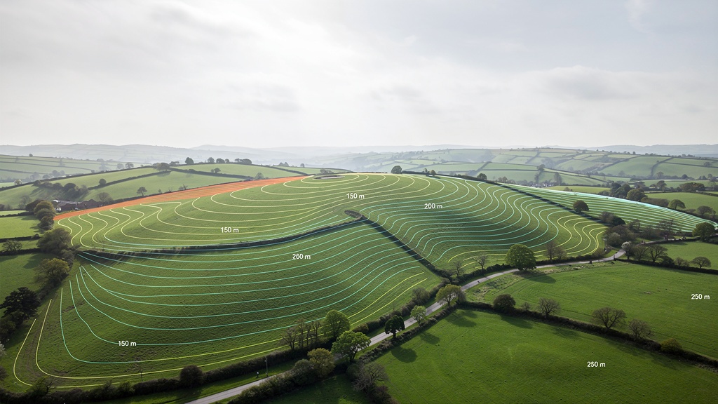
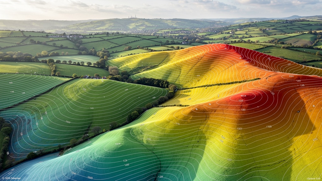
Ground Levels and Contours
The ground surface is measured at a dense grid of points across the site, and the resulting data is used to generate contour lines at a specified interval — typically 0.25 m for residential plots and 0.5 m for larger development sites. Spot heights are recorded at key locations such as finished floor levels, threshold heights, drainage points and site access positions. This contour data is the foundation for drainage design, flood risk assessment, cut-and-fill calculations and structural engineering.
Natural Features
All significant natural features within and adjacent to the survey area are recorded: ponds, streams, ditches, rivers, embankments, slopes, rock outcrops and areas of standing water. Where watercourses exist, the survey typically captures cross-sections, bank levels and any culverted or bridged crossings.
Man-Made Features
Buildings (with floor levels, eaves heights and ridge heights), walls, fences, roads, footpaths, kerb lines, parking areas, verges, street furniture, utility poles and any other constructed feature on or adjacent to the site are recorded. Neighbouring buildings adjacent to the survey boundary are also typically picked up — at minimum their ground-floor and eaves levels — because they are often relevant to planning and design decisions.
Trees and Vegetation
Tree positions are recorded along with species, stem diameter (DBH), estimated height and crown spread. For planning applications involving trees, a full BS5837 tree survey — which classifies trees by category (A, B, C, U) and specifies their root protection areas — can be integrated directly into the topographic survey data, avoiding a separate survey visit.
Underground Services and Drainage
The positions of manholes, inspection chambers, gullies, soakaways and other drainage features are recorded with their cover levels and (where accessible) invert levels. Utility covers (gas, electric, telecoms, water, BT) are also recorded. We always recommend a dedicated CAT (Cable Avoidance Tool) scan in addition to the topographic survey where underground utility mapping is critical — the topo survey records what's visible at surface level, not what's buried.
Boundary Features
Fences, walls, hedges, ditches and other boundary features are recorded with their positions and heights. Where boundary features are ambiguous or where the survey is being used to inform a boundary assessment, the surveyor can note the physical evidence carefully — though definitive legal boundary determination requires a dedicated boundary survey and title deed analysis.
OS Grid and Datum Referencing
All survey data is referenced to the Ordnance Survey national grid (OSGB36 coordinate system) and Ordnance Datum Newlyn (ODN) for heights. This is standard practice for professional topographic surveys and ensures the data integrates correctly with OS mapping, Environment Agency flood models, and the data produced by other consultants on your project. Always confirm this when commissioning any survey — some low-cost providers use assumed or local datums, which are far less useful.
Why Do You Need a Topographical Survey?
Here is a story that illustrates the value of a topographical survey — very well.
A few years ago we were approached by a homeowner in Worcestershire who wanted to build a rear extension. Her architect had already produced a design based on an estate agent's floor plan and a rough sketch of the garden. They were two weeks from submitting the planning application when they realised the garden sloped significantly more than expected. The proposed design would need major structural modifications to accommodate the actual ground levels — specifically, the rear of the extension would need to be raised nearly 900 mm above the natural ground level on a retaining structure the original design hadn't accounted for.
The result: a three-month delay, redesign costs running to several thousand pounds, and a planning application fee they couldn't recover. The whole situation was entirely avoidable. A topographic survey commissioned at the outset would have revealed the slope, the architect would have designed for it from the start, and the application would have gone in first time.
This is not an unusual story. Here is what happens when there is no accurate survey data:
- Drainage can't be designed correctly — without precise ground levels, a drainage engineer is guessing about fall gradients, catchment areas and outfall points
- Cut-and-fill volumes are guesswork — developers who skip the survey regularly discover unexpected earthworks costs after contracts are signed
- Planning applications get refused — local planning authorities increasingly ask for detailed level information, particularly on sloping sites, flood risk zones or tree-sensitive sites
- Flood risk assessments are compromised — the hydraulic models underlying a flood risk assessment are only as good as the survey data beneath them
- Construction errors occur — setting out positions from inaccurate data leads to foundations in the wrong place, drainage at the wrong level, and structural elements that don't connect correctly
"A topographic survey isn't a bureaucratic formality — it's the foundation on which good design is built. Without it, your architect is essentially designing blind."
Commissioning a topographic survey is one of the most cost-effective investments you can make at the start of any development project. For a standard residential project, a survey costs between £500 and £1,500 + VAT. The cost of a single redesign, a delayed planning application or a construction error is almost always several times that figure.
Who Needs a Topographical Survey?
Almost anyone undertaking a development, construction or significant landscaping project will benefit from a topographical survey. The most common clients who require or commission one are:
Architects and Architectural Technologists
A topographic survey is the base data on which all good design is built. Architects use the survey to understand site levels, drainage patterns, tree positions and the relationship between the proposed development and its neighbours. Without accurate survey data at RIBA Stage 1 or Stage 2, design decisions are made on assumptions — and assumptions lead to errors and revisions that cost time and money later.
Property Developers and Housebuilders
Developers need topographic data at every stage of the project — from initial feasibility (understanding what the land will accommodate) through to detailed design, drainage strategy and construction setting out. The earlier the survey is commissioned, the more value it delivers: the same data that informs the planning application can be used by every technical consultant on the project.
Self-Builders
If you're planning to build your own home, a topographic survey is essential. It will tell you exactly what you're working with, identify potential issues (drainage, flooding, trees, level changes) before you commit to a design, and give your architect and structural engineer the data they need to produce accurate drawings.
Planning Consultants
Many planning applications — particularly those involving level changes, flood risk, trees or complex sites — require detailed topographic information as supporting material. A professionally produced topographic survey referenced to OS datum is increasingly expected by local planning authorities and cannot be substituted with sketch plans or OS map extracts.
Local Authorities and Public Bodies
Local authorities commission topographic surveys for infrastructure planning, public realm improvements, flood risk management, road design and many other purposes. Environmental agencies and utilities companies also commission topo surveys for watercourse management, drainage studies and network maintenance.
Solicitors, Conveyancers and Land Registry
Where a property transaction involves irregular boundaries, disputed land, development land or complex title issues, a professionally produced topographic survey may be required to inform the legal process. Similarly, Land Registry applications for first registration or title updates to reflect boundary changes may need professionally surveyed plans.
Homeowners
Extensions, garden re-landscaping, garage conversions, drainage improvements and boundary clarification are all reasons homeowners commission topographic surveys. The cost is modest relative to the project value, and the data is directly useful to both the homeowner and any professional consultants involved.
How Does a Topographical Survey Differ from Other Types of Survey?
The word "survey" covers a wide range of professional services. Here's how a topographical survey relates to — and differs from — the other types of survey you're most likely to encounter:
Topographical Survey vs Measured Building Survey
A measured building survey focuses on the interior and exterior of an existing building — capturing floor plans, elevations, sections and roof plans. A topographic survey focuses on the land around and outside the building. Many development projects require both: the topographic survey provides site context (levels, boundaries, drainage), and the measured building survey provides the building record (floor plans, structural elements, room dimensions). Both are often commissioned together as a combined survey, which is more efficient and cost-effective than two separate site visits.
Topographical Survey vs Boundary Survey
A boundary survey focuses specifically on the legal position of property boundaries — analysing title deeds, conveyance plans, Land Registry data and physical evidence on the ground to determine where boundaries legally lie. A topographic survey records the physical boundary features (fences, walls, hedges) in precise positions, but does not determine their legal status. For boundary disputes or Land Registry applications, a dedicated boundary survey is required. Topographic survey data often forms part of the evidence base for a boundary survey.
Topographical Survey vs RICS HomeBuyer Report / Building Survey
A HomeBuyer Report or Building Survey (sometimes called a structural survey) is a condition assessment of a property carried out for a buyer — it assesses the physical condition of the building and highlights defects, maintenance requirements and risks. It is entirely different from a topographic survey and is not relevant to development projects.
Topographical Survey vs Ordnance Survey Mapping
Ordnance Survey maps — including OS MasterMap, the most detailed OS product — are generalised national datasets produced at consistent accuracy for the entire country. They are not site-specific surveys. OS MasterMap achieves positional accuracy of approximately ±0.5–1 metre; a professional topographic survey achieves ±10–50 mm — fifty to one hundred times more accurate. OS mapping is appropriate for location plans on planning applications (a statutory requirement); it is not appropriate as the basis for architectural design, engineering calculations or precise boundary measurement. Read our detailed guide: Ordnance Survey vs Topographic Survey.
Topographical Survey vs Drone Survey
A drone survey uses an unmanned aerial vehicle (UAV) equipped with a camera and photogrammetry software to capture elevation data and aerial imagery of a site. Drone surveys can be fast and efficient for large, open sites — but they have limitations: they struggle in wooded areas, they cannot capture data under dense canopy, they are subject to weather and airspace restrictions, and they typically achieve lower vertical accuracy than ground-based surveys. In practice, most topographic surveys of mixed sites use a combination of ground-based total station and GPS data collection, with drone survey as a supplementary tool for open area terrain modelling where appropriate. Read more: Drone Survey vs Ground Survey.
What Equipment Does a Topographical Surveyor Use?
To carry out a high-quality topographic survey, our team uses a combination of specialist precision instruments:
Total Station
A total station is the core instrument of a traditional land survey. It is an electronic theodolite with an integrated distance measurement unit (EDM) that measures angles and distances to a reflective prism target held at each feature to be surveyed. Combined with the known position of the instrument, this allows the exact three-dimensional coordinates of any feature to be calculated. Modern total stations achieve angular accuracy of 1–5 arc seconds and distance accuracy of ±2mm + 2ppm — sufficient for any level of topographic survey work. Total stations perform reliably in any environment, including dense urban settings, woodland, and any situation where sky visibility is restricted.
GPS / GNSS (RTK)
RTK GNSS (Real-Time Kinematic Global Navigation Satellite System) uses satellite positioning enhanced by real-time corrections from a base station or correction network (such as OS Net) to achieve positioning accuracy of ±10–20 mm horizontally and ±20–30 mm vertically. GNSS is fast and efficient for open sites — a single surveyor can collect hundreds of points per day without the need for a fixed instrument setup. It is used to establish the site control framework (the reference points from which the total station works) and to supplement total station data collection on large open areas. For detailed guidance on GPS vs total station, see our article: GPS vs Total Station.
3D Laser Scanner
A 3D laser scanner (terrestrial LiDAR) captures millions of data points per second, building up a dense three-dimensional point cloud of everything within its range. This is particularly useful for complex buildings, heritage structures, industrial plant and any situation where a very high density of measurements is required quickly. Point cloud data can be used to produce measured building drawings, as-built records, BIM models and highly detailed topographic survey drawings. For more on this technology, see our full guide: 3D Laser Scanning: A Complete Guide.
Data Collectors
Field-hardened tablets and data logging devices are used to record measurements, feature codes and notes on site. Survey data is collected in real time, organised by feature type and exported to the office for processing. Modern survey data collectors run sophisticated field software that guides the surveyor through the data collection process, reduces errors and creates a clean, structured dataset ready for CAD processing.
Drone (UAV)
For large sites — typically 5ha+ — a survey drone fitted with a calibrated survey-grade camera can be used to capture aerial photogrammetric data. Drone data provides high-resolution aerial imagery and a dense terrain model of open areas efficiently. It is used as a supplement to ground survey data, particularly for open farmland, quarries, waste sites and large greenfield development land.

How Long Does a Topographic Survey Take?
The duration of a topographic survey depends on several factors: site size, site complexity, level of detail required and method of survey. Here are realistic time estimates for common project types:
Residential Garden or Small Plot (up to 0.1 ha)
On site: half a day (3–4 hours) for a standard residential garden survey. A straightforward plot with clear access can be completed faster; a more complex site with dense vegetation, multiple level changes or restricted access may take a full day.
Office processing and drafting: two to three days. This involves downloading and processing the field data, generating the contour model, drawing all features in CAD, adding annotation, referencing to OS datum and producing the final drawing in the specified formats.
Small to Medium Development Site (0.1–0.5 ha)
On site: one full day, occasionally one and a half days for complex sites with many features, significant level changes or dense tree cover.
Office: three to four days for processing and CAD drafting.
Medium Commercial or Development Site (0.5–2 ha)
On site: one to two days, depending on complexity. Sites with buildings, multiple drainage features, extensive tree cover or restricted access take longer.
Office: four to six days processing and drawing.
Large Development Site (2–10 ha)
On site: two to four days. Drone survey may supplement ground survey for large open areas, reducing the total on-site time.
Office: five to ten days. Larger sites require significantly more CAD drafting time to produce a complete and legible drawing at an appropriate scale.
We confirm the programme — including site visit date and drawing delivery date — in writing with every quotation. Our standard turnaround from site visit to drawing delivery is five to ten working days for most residential and small commercial projects. Rush delivery (three to five days) is available on request at a modest premium.
What Format Will I Get My Survey In?
Our standard deliverable is an AutoCAD DWG file referenced to OS national grid and ODN datum. This is the industry standard format used by architects, engineers and planning consultants across the UK, and it integrates directly with all major CAD and BIM software. We also provide:
- PDF plan (A1 or A3) at a specified scale — typically 1:200 or 1:500 for residential projects; 1:500 or 1:1000 for larger sites
- DXF format — for import into non-AutoCAD CAD applications (Vectorworks, MicroStation, ArchiCAD, etc.)
- GeoTIFF — for import into GIS applications (QGIS, ArcGIS, MapInfo)
- Point cloud files (LAS/LAZ) — where 3D laser scanning has been used, the raw point cloud is provided alongside the derived CAD drawing
- Revit / IFC format — for projects where BIM integration is required, on request
All our drawings include a title block with OS datum information, a north arrow, a scale bar, a drawing number and revision control. Drawings are always checked by a senior surveyor before delivery.
If you need a format not listed here — or if you have a specific layering convention you need the drawing to follow (for example, your practice's standard CAD template) — just let us know when requesting your quote. We can accommodate most requirements.
How Much Does a Topographic Survey Cost?
Survey costs vary based on site size, complexity and the level of detail required. As a rough guide for UK projects in 2025:
- Small residential garden (up to 0.1 ha) — £500–£900 + VAT
- Residential development plot (0.1–0.25 ha) — £850–£1,400 + VAT
- Medium development site (0.25–0.5 ha) — £1,200–£2,000 + VAT
- Commercial site (0.5–2 ha) — £1,800–£4,500 + VAT
- Large development site (2–10 ha) — £3,500–£10,000+ + VAT
These are indicative figures. The actual cost for your site depends on the specific scope, access conditions, distance from our nearest surveyor and any specialist elements (BS5837 tree data, watercourse cross-sections, measured building survey elements). We provide a fixed-price written quotation within 24 hours of receiving your site details. For a detailed breakdown of what drives survey costs, see our full guide: How Much Does a Topographic Survey Cost?
Real-World Case Study: Residential Extension, Worcestershire
The Project
A homeowner in Malvern, Worcestershire, wanted to build a single-storey kitchen extension at the rear of her Victorian terraced house. The garden was on a slope — not dramatically, but enough to cause issues.
The Problem Without a Survey
The original architect (not engaged by us) had designed the extension based on an estate agent's floor plan from 2018 and a brief site visit. The design assumed roughly level ground. When the planning application was submitted, the planning officer noted that the application drawings didn't show how the extension would relate to the garden levels. A topographic survey was requested as a condition of the application.
What the Survey Revealed
Our survey showed that the garden sloped downward at approximately 1 in 12 from the rear of the house — a total fall of 840 mm over the footprint of the proposed extension. The proposed floor level would have resulted in a 450 mm step at the rear threshold — a structural and planning issue. The drainage outfall position also needed revision. With the survey data, the architect redesigned the extension on a level structural slab with appropriate retaining walls, and the revised planning application was approved without further queries.
The Numbers
- Survey cost: £620 + VAT
- Delay caused by not having the survey originally: 14 weeks
- Additional architect fees for redesign: approximately £1,200
- Total cost of not commissioning the survey at the outset: approximately £1,800 + 14 weeks of programme loss
Comparison: Topographic Survey vs Other Survey Types
| Survey Type | What It Records | Typical Use | Accuracy |
|---|---|---|---|
| Topographic Survey | Ground levels, contours, features, boundaries, trees, drainage | Planning, design, engineering, flood risk | ±10–50 mm |
| Measured Building Survey | Building floor plans, elevations, sections, room dimensions | Renovation, conversion, extension design | ±5–20 mm |
| Boundary Survey | Legal boundary positions, documentary analysis, physical evidence | Boundary disputes, Land Registry, conveyancing | ±5–20 mm |
| OS MasterMap | General features, building outlines, roads — national dataset | Planning location plans, background context | ±500–1000 mm |
| Drone Survey | Aerial imagery, terrain model (open areas only) | Large open sites, earthworks monitoring | ±30–100 mm (ground control dependent) |
| RICS Building Survey | Building condition, defects, maintenance issues | Property purchase due diligence | N/A (condition assessment, not measurement) |
Frequently Asked Questions About Topographical Surveys
For a very simple, flat, urban extension with no level changes, no trees within influence distance and no drainage complexity, a topographic survey may not be essential — your architect may be able to produce adequate measured drawings directly. However, any time there is a slope, nearby trees protected by a TPO, a drainage constraint, a flood risk zone, or any uncertainty about boundary positions, a topographic survey is always worthwhile. The cost of a survey for a small residential plot (£500–£900 + VAT) is tiny compared to the cost of a planning refusal, a redesign or a construction error caused by inaccurate site data. When in doubt, commission the survey — you will not regret it.
The following scenarios almost always require a topographic survey as part of a planning application: sites with any significant change in level (more than about 300 mm across the site); sites in or adjacent to flood zones (Flood Zone 2 or 3, or any site requiring a Flood Risk Assessment); sites with trees subject to Tree Preservation Orders or in Conservation Areas; sites where the relationship between proposed finished floor levels and adjacent property levels is material; and major developments of any kind. Many local planning authorities now specify in their validation requirements that topographic survey information must be submitted with applications on such sites. It's also worth asking your planning consultant or architect whether a survey is required — they will often make this recommendation as a matter of course.
No. Google Earth and Bing Maps provide useful general context but are completely unsuitable as a substitute for a professional topographic survey. The imagery may be several years out of date. The positional accuracy varies enormously (typically ±1–5 metres). There is no ground level data suitable for engineering or planning use. Google's terms of use prohibit use of their imagery in professional planning or design documents. For planning applications, OS-licensed mapping must be used for location plans, and a professional topographic survey is required wherever level or feature information is needed for design.
A Land Registry title plan shows the general extent of a registered property title, based on OS MasterMap. It is not a precise survey — the boundary lines on a Land Registry title plan have positional accuracy of approximately ±1 metre and are a general indication of ownership, not a precise boundary measurement. A topographic survey records the physical features of the land (including boundary features) to centimetre-level accuracy. For any purpose where precise boundary positions matter — boundary disputes, development near boundaries, precise legal descriptions — a professional survey is essential. The Land Registry title plan and the topographic survey serve different purposes and are both valuable, but they cannot substitute for each other.
We typically mobilise within five working days of receiving a confirmed commission for most residential and small commercial surveys. For large or complex sites we may need a slightly longer lead time — typically seven to ten working days. If you have an urgent deadline, contact us as soon as possible — we can often accommodate rush commissions if we have capacity in the schedule. We're a UK-wide service, so lead times are similar regardless of location, though remote sites (such as some parts of Scotland, Cornwall or the Scottish islands) may require slightly more notice for logistics.
You don't need to be present throughout the survey. What we do need is access to the site — including any locked gates, garages, outbuildings or gardens that form part of the survey area. If access requires coordination with neighbours (for example, to survey up to their boundary), it's helpful to arrange this in advance. We'll confirm access requirements when the survey is booked. Some clients like to be on site at the start of the survey visit to discuss any specific requirements — this is always welcome but not essential.
The OS national grid is the coordinate reference system used for all British mapping. When a survey is "referenced to OS national grid", it means that every point in the survey has a pair of national grid coordinates (Eastings and Northings) that place it at a precise location within the overall national coordinate system. This allows the survey to be overlaid correctly on OS maps, integrated with data from other consultants, and related to Environment Agency flood mapping (which also uses OS grid references). "ODN datum" (Ordnance Datum Newlyn) is the vertical reference — all height values in the survey are expressed as metres above mean sea level as measured at the Newlyn tide gauge. This is the standard reference for heights in Great Britain and ensures that your survey data is consistent with EA flood data, utilities records and any other professionally referenced dataset. Always confirm that any survey you commission is referenced to OS national grid and ODN datum — surveys using local or assumed datums cannot be properly integrated with other data sources.
A standard topographic survey drawing includes: ground contours (typically 0.25 m or 0.5 m interval), spot heights at key locations, all visible above-ground features (buildings, walls, fences, roads, kerbs, paths, vegetation, trees), drainage covers and inspection chambers (with cover levels), utility covers, and boundary features. What is typically not included unless specifically requested: interior floor plans of buildings (that's a measured building survey element), underground utility routes (a CAT scan is required for this), legal boundary positions (that's a boundary survey), structural condition information, or tree root protection areas (BS5837 data can be added for an additional fee). Always check the survey specification carefully before commissioning to ensure you're getting everything you need for your project.
Key Points: What to Know About Topographic Surveys
- A topographic survey captures the precise physical features of your land — levels, contours, features and boundaries
- It is site-specific, produced exactly for your project — unlike Ordnance Survey mapping, which is a generalised national dataset
- Accuracy is ±10–50 mm — fifty to one hundred times more accurate than OS MasterMap
- It is referenced to OS national grid and ODN datum — ensuring integration with all other professional data
- It is essential for planning applications on complex sites, for architectural and engineering design, and for flood risk assessment
- Typical cost for a residential plot: £500–£1,500 + VAT — a fraction of the cost of a planning refusal or construction error
- Typical turnaround: five to ten working days from site visit to drawing delivery
- Deliverables: AutoCAD DWG (standard), plus PDF, DXF, GeoTIFF and point cloud on request
Related Articles
- Do I Need a Topographic Survey for Planning Permission?
- How Much Does a Topographic Survey Cost in the UK?
- GPS vs Total Station: Which Equipment Is Right for Your Survey?
- Ordnance Survey vs Topographic Survey: What's the Difference?
- Why Architects Always Need a Topographic Survey First
- Why Your Flood Risk Assessment Starts With a Topographic Survey
Ready to Commission Your Topographical Survey?
Our accredited topographical survey services team is ready to help. Contact us for a free, fixed-price quote within 24 hours — no obligation.
Get a Free Quote