It's one of the most common sources of confusion in the surveying industry — and it costs clients money every year. People use the terms "Ordnance Survey" and "topographic survey" interchangeably, as if they refer to the same thing. They don't. They are fundamentally different products, produced for different purposes, to different standards and at different scales.
Using an Ordnance Survey map as a substitute for a site-specific topographic survey is not just inadequate — it's a risk that can lead to planning refusals, design errors and costly remediation during construction. I've seen it happen, and it's always more expensive to fix after the fact than to commission the right survey at the start.
In this guide, I want to explain clearly and plainly what Ordnance Survey mapping is, what a topographic survey is, why they're different and when each is appropriate.
What Is Ordnance Survey?
The Ordnance Survey (OS) is the national mapping agency of Great Britain. Founded in 1791, it is responsible for producing and maintaining a comprehensive suite of geographic data products covering the whole of Great Britain — maps, digital datasets, aerial imagery and more.
OS data products range from the small-scale 1:250,000 Landranger maps familiar to walkers, to the large-scale 1:1,250 MasterMap products used for planning and property conveyancing. These products are produced through a combination of field survey, aerial photography and photogrammetry, and are updated on a rolling programme.
OS data is authoritative, consistent and available at national scale. It is the background against which the whole of the UK's planning, conveyancing, infrastructure and emergency services systems operate. It is, genuinely, an extraordinary national asset.
But here's the key point: OS mapping is a generalised national dataset, not a site-specific survey. It was not produced for your site, at the accuracy your project requires, with the specific features your design team needs to capture.
What Is a Topographic Survey?
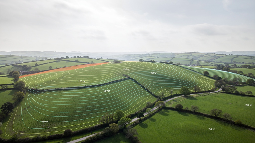
A topographic survey (also called a topo survey or land survey) is a site-specific measured survey, carried out by a qualified land surveyor using precision instruments, to capture the precise physical characteristics of a specific piece of land or a specific building.
Unlike OS mapping — which is produced systematically across the whole country and updated at a national programme frequency — a topographic survey is commissioned specifically for your project, at the level of detail your project requires, at the time your project needs it.
The result is a CAD drawing — typically referenced to the OS national grid and datum — that shows the exact positions, dimensions and levels of all features on your specific site, accurate to centimetre level.

The Key Differences: OS Mapping vs Topographic Survey
The differences between OS mapping and a topographic survey are significant and consequential. Here's a clear breakdown:
Accuracy
OS MasterMap (the most detailed OS product) is accurate to approximately ±1 metre horizontally for most features, with some features accurate to ±0.5 metres. This is the most detailed OS product available for general use. For a planning drawing at 1:200 scale, a ±1 metre positional error equates to 5mm on the drawing — which sounds small, but represents the difference between a building sitting 1 metre inside the boundary and 1 metre outside it.
Topographic survey achieves horizontal accuracy of ±10–50mm, depending on specification and equipment — fifty to one hundred times more accurate than OS MasterMap. This is the accuracy that design and construction work requires.
Currency
OS mapping is updated on a rolling programme, but any given area may not have been resurveyed for months or years. New buildings, demolished structures, boundary changes, new drainage installations and earthworks may not be shown. For any site that has changed since the last OS survey, the mapping may be significantly out of date.
Topographic survey is carried out on the date you commission it and reflects the site conditions as they exist at that moment. It is always current for your project.
Level of Detail
OS mapping shows generalised features — building outlines, road centrelines, boundary lines, woodland areas. It does not show ground levels (contours), tree sizes, manhole positions, drain runs, finished floor levels, wall heights or any of the feature-level detail that design and construction work requires.
Topographic survey captures all physical features of the site to the level of detail specified — including ground levels and contours, all drainage features with cover and invert levels, tree positions with BS5837 data, all boundary features with heights, all buildings with floor and ridge levels, and any other feature relevant to the project.
Height Data
OS mapping (in its standard map products) does not include precise ground level data for specific sites. While contour data is available in some OS digital products (DTM — Digital Terrain Model), this is derived from aerial survey data and does not achieve the accuracy required for engineering or planning work.
Topographic survey captures precise ground levels across the site, referenced to Ordnance Datum Newlyn, to the accuracy required for drainage design, flood risk assessment and structural engineering.
Site Specificity
OS mapping is a national dataset — it covers everything, but captures nothing about your specific site in more detail than any other site. It cannot be updated for your project or tailored to your requirements.
Topographic survey is produced specifically for your site, at your required level of detail, for your project's specific purposes. The surveyor can focus attention on the features that matter most for your design — the relationship between the proposed development and the drainage, the adjacent trees, the neighbouring buildings — in a way that national mapping never can.
Legal Status
OS mapping has no legal status as a site survey. It is not produced by a professional surveyor accepting responsibility for site-specific accuracy. It cannot be used as evidence in planning disputes, boundary disputes or legal proceedings in place of a professional survey.
Topographic survey produced by a qualified surveyor carries the surveyor's professional responsibility for accuracy. It can be used as evidence in planning applications, court proceedings and Land Registry applications.
When Is OS Mapping Appropriate?
OS mapping is not useless — far from it. It is an authoritative, comprehensive, nationally consistent dataset that plays an essential role in many planning and property contexts. Here's where OS mapping is appropriate:
- Location plans — every planning application requires a 1:1,250 or 1:2,500 OS-based location plan showing the application site in its wider context. This is a legitimate and required use of OS mapping.
- Background context — OS mapping is excellent as a background layer behind a detailed topographic survey, showing the wider site context (neighbouring roads, general land use, watercourses) to which the site-specific survey data can be related.
- Strategic studies — for area-wide assessments, masterplanning at district scale, infrastructure corridor studies and other work where site-specific accuracy isn't required, OS data is wholly appropriate.
- Land registry title plans — the Land Registry uses OS MasterMap as the basis for title plans. This is appropriate for general registration of ownership, but (as noted above) not for precise boundary determination.
- Emergency services and navigation — OS data is the backbone of emergency services mapping, vehicle navigation, utilities management and many other national functions where consistent national coverage matters more than site-specific accuracy.
When You Must Have a Topographic Survey (Not Just OS Mapping)
There are clear situations where OS mapping is insufficient and a site-specific topographic survey is essential:
- Any planning application where levels are material — sloping sites, flood risk zones, sites with trees, sites requiring drainage strategy
- Architectural and engineering design — at any stage where decisions will be made based on site levels or feature positions
- Flood risk assessments — OS mapping does not contain the level accuracy required for hydraulic modelling
- Boundary disputes — OS mapping is explicitly insufficient for boundary determination
- Construction setting out — you cannot set out a building accurately from an OS map
- As-built records — OS mapping cannot record what has been built to the accuracy required for Building Regulations or Land Registry purposes
"An Ordnance Survey map shows you where you are. A topographic survey shows you exactly what's there — and that's a very different thing."
Understanding OS National Grid and Datum
One area where OS mapping and topographic surveys are closely related — and it's important to understand this — is the coordinate reference system. Professional topographic surveys are referenced to the OS national grid coordinate system and Ordnance Datum Newlyn (ODN).
This means that while a topographic survey captures data at far greater accuracy and detail than OS mapping, it uses the same underlying coordinate system. This is important because it allows the site survey to be:
- Overlaid correctly on OS mapping for context and planning purposes
- Related to Environment Agency flood level data, which is also expressed in ODN
- Integrated with utility records, which typically use OS national grid coordinates
- Compared with Land Registry title plans, which are based on OS mapping
When you commission a topographic survey from a professional surveyor, always confirm that the survey will be referenced to OS national grid and ODN datum. Some low-cost surveys use local or assumed datums — these cannot be integrated with OS data or EA flood maps, which limits their usefulness considerably.
The Relationship Between OS and Topographic Surveys on a Planning Application
On a typical planning application, both types of data are used — but for different purposes:
- OS MasterMap / OS Explorer — used for the statutory location plan showing the application site at 1:1,250 scale in its wider context
- Topographic survey — used for all planning drawings that show the site in detail: existing site plan, proposed site plan, site sections, drainage layout, tree survey
The topographic survey is typically used as the base drawing, with the OS-referenced coordinates ensuring it aligns correctly with the OS location plan. This integration is seamless when the topographic survey is properly referenced to OS national grid — and it fails when it's not.
FAQ: Ordnance Survey vs Topographic Survey
Google Maps and Google Earth imagery are useful for general context and initial site assessment, but they are not appropriate as the basis for planning drawings, design work or any professional purpose. The imagery may be years out of date, the positional accuracy varies considerably (typically ±1–5 metres), there is no official scale or coordinate reference system, and Google's terms of use prohibit use of the imagery in professional documents. For planning applications, OS-licensed mapping must be used for location plans.
No. The Ordnance Survey is a national mapping agency — it produces national-scale datasets, not site-specific surveys. For site-specific topographic surveys, you need to commission a private land surveying company. The OS does licence its data (maps, OS MasterMap, etc.) to surveyors and planning consultants, and professional topographic surveys are always referenced to the OS national grid system — but the survey itself is entirely separate from OS data products.
OS MasterMap is the Ordnance Survey's most detailed and accurate topographic data product — a continuously maintained national dataset at scales equivalent to 1:1,250 in urban areas. It is more accurate and more up to date than standard OS maps, and it is the data used for Land Registry title plans and planning location plans. However, even OS MasterMap has positional accuracy of only ±0.5–1 metre for most features, which is insufficient for design, engineering or precise boundary determination. A professional topographic survey achieves accuracy fifty to one hundred times better than OS MasterMap.
An OS map is a licensed copy of existing national data — it costs a modest licence fee because the production cost is spread across millions of users of the national dataset. A topographic survey is produced entirely for your specific site, on demand, by qualified professionals using precision instruments. The cost reflects the surveyor's time (typically half a day to two days on site, plus two to five days of office processing), the equipment investment and the professional overhead. The output is also fundamentally different — a topographic survey contains fifty times more information, at fifty times the accuracy, specifically tailored to your project.
No. Planning applications require an OS-licensed location plan (typically 1:1,250 scale) showing the application site highlighted on an OS map extract. This is a statutory requirement — it shows the application site in its broader national context and uses the familiar OS format that planners and consultees can easily relate to. The topographic survey is used for the detailed planning drawings (site plan, sections, drainage) — it cannot replace the OS location plan.
The Environment Agency provides free LiDAR data (aerial survey-derived elevation data) through its Open Data portal, covering most of England. This is useful for strategic flood risk assessment and landscape analysis, but its accuracy (typically ±15cm vertically, 1–2m resolution) is insufficient for site-specific design, planning surveys or detailed engineering. The OS also provides some free data products through OS OpenData, but these are less detailed than the licensed products. For site-specific design and planning work, there is no substitute for a professionally commissioned topographic survey.
Related Articles
Need a Site-Specific Topographic Survey?
Our professional topographic survey services provide the precise, site-specific data that OS mapping can't. Free quote within 24 hours.
Get a Free Quote