When I joined Surveyor Topographer, 3D laser scanning was still considered a specialist — and expensive — technology used mainly on large infrastructure and heritage projects. Today, it's part of our standard toolkit for a surprisingly wide range of commissions, from Georgian townhouses to industrial warehouses. The technology has become faster, more accurate and more accessible.
But for many of our clients — architects, developers, project managers and property owners — laser scanning still feels like a black box. They know it produces impressive visuals, but they're not sure when they actually need it, what it costs, or what they'll receive at the end.
This guide explains exactly how 3D laser scanning works in practice, when it adds genuine value over conventional survey methods, what the deliverables look like, and how to decide whether it's the right approach for your project.
What Is 3D Laser Scanning?
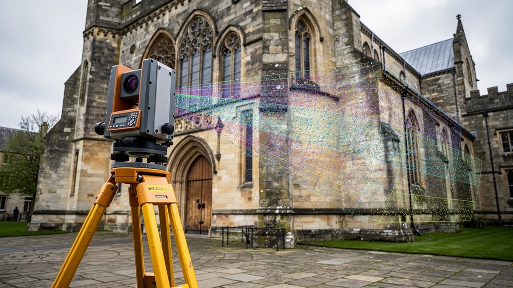
A 3D laser scanner (also called a terrestrial LiDAR scanner) is a precision instrument that captures the geometry of a space or structure by firing a laser beam in rapid succession across its field of view. The scanner measures the distance to every surface the laser beam hits, recording millions of individual measurements per second. Each measurement becomes a point in three-dimensional space — a data point with X, Y and Z coordinates, plus intensity and (on colour-capable scanners) RGB values.
The result is a point cloud — a dense three-dimensional representation of everything the scanner could see from its position. By placing the scanner in multiple locations and registering (stitching together) the resulting point clouds, a complete 3D model of a space or structure can be built up with extraordinary detail and accuracy.
Modern laser scanners can capture up to two million points per second and achieve positional accuracy of ±2–3mm at distances of up to 30 metres. For complex structures, intricate interiors or anything where conventional tape-and-total-station measurement would be time-consuming, dangerous or simply impractical, laser scanning transforms both the speed and the quality of the survey.
How Does 3D Laser Scanning Work in Practice?
Here's what happens during a typical 3D laser scanning survey, step by step:
Stage 1: Site Setup and Control
Before the scanner is deployed, the survey team establishes a network of control targets — small, precisely measured reference markers placed around the site. These targets allow the individual scanner positions (called "scans") to be registered together into a single, coherent coordinate system. Where the survey needs to be referenced to OS national grid and datum, GPS control points are also established.
Stage 2: Data Capture
The scanner is set up at each planned station point and left to rotate and capture data. Depending on the resolution setting and the scanner model, a single scan typically takes between two and ten minutes. The scanner captures everything in its field of view — walls, floors, ceilings, furniture, structural elements, external facades, ground surfaces. Nothing is missed.
For a typical three-storey building, we might deploy the scanner at 30–60 positions to ensure complete coverage without data gaps. For a large historic building, this might extend to 100+ positions over multiple days.
Stage 3: Registration
Back in the office, all the individual scans are processed and registered — aligned and merged into a single unified point cloud. Modern registration software uses the control targets and intelligent automatic matching algorithms to ensure the registration is accurate, typically to within ±2–3mm.
Stage 4: Processing and Derivation
The registered point cloud is then used as the source data from which the survey deliverables are produced. This might involve:
- Tracing floor plans, elevations and sections directly from the point cloud in CAD software
- Generating a mesh model (a solid 3D surface model) from the point cloud data
- Building a BIM model (in Revit or similar software) using the point cloud as a reference
- Exporting the point cloud directly (in LAS, E57 or RCP format) for use by the client's design team
When Should You Use 3D Laser Scanning?
Laser scanning is not always necessary — for a simple boundary survey or a standard topographic survey of an open site, conventional equipment (total station and GPS) is faster and more cost-effective. But there are specific scenarios where laser scanning genuinely transforms the quality and efficiency of the survey:
Complex Historic and Heritage Buildings
This is where laser scanning comes into its own. Irregular geometries, curved walls, vaulted ceilings, intricate decorative features — all of these are captured automatically and completely by the scanner, without requiring a surveyor to physically measure every individual detail. A church, a Victorian factory, a Georgian terrace — all can be surveyed to sub-centimetre accuracy in a fraction of the time it would take with conventional methods.
For heritage applications, the completeness of the data record is itself valuable. A laser scan of a historic building captures its precise state at a moment in time — invaluable for conservation planning, condition monitoring and emergency response to damage.
Refurbishment and Conversion Projects
When an existing building is being converted or refurbished, architects need accurate floor plans, elevations and sections as the basis for their design. Laser scanning produces this data quickly, accurately and completely — including ceiling heights, structural column positions, window reveal depths and all the irregular features that make existing buildings so challenging to measure manually.
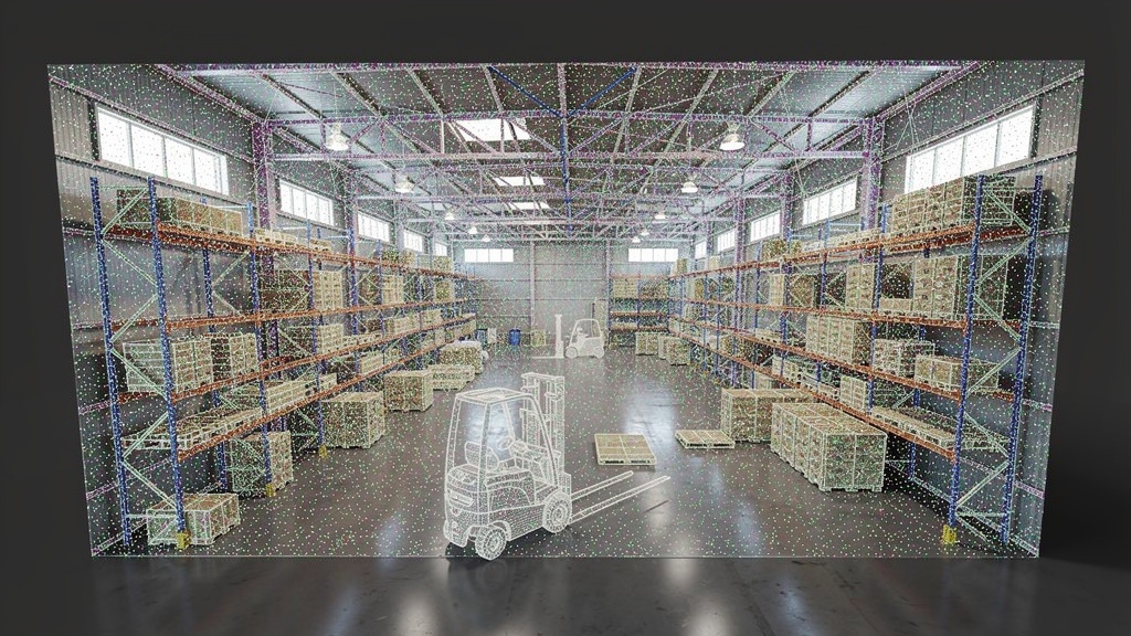
Industrial Plant and Infrastructure
Pipework, steelwork, plant rooms, industrial machinery — complex three-dimensional layouts that are practically impossible to measure comprehensively with conventional methods. Laser scanning captures them completely, allowing engineering teams to model pipe routes, plan new installations and detect clashes before they happen on site.
Façade and External Envelope Surveys
For buildings where the external appearance is important — listed buildings, buildings in conservation areas, or any structure where façade condition, material deformation or movement needs to be monitored — laser scanning provides a detailed baseline record that can be revisited and compared over time.
As-Built Verification
Scanning a completed construction against the design model reveals any deviations from design intent. This is increasingly specified by clients and contractors on major construction projects as a quality assurance measure, and it's far more comprehensive and objective than visual inspection.
What Are the Deliverables from a 3D Laser Scan?
The deliverables you receive will depend on what you need — and it's important to specify this clearly when commissioning the survey. Here are the most common options:
Point Cloud Files
The raw (registered) point cloud, supplied in one or more of the following formats:
- LAS / LAZ — the standard geospatial point cloud format, compatible with most GIS and survey software
- E57 — an open standard format for point cloud data, widely compatible
- RCP / RCS — Autodesk's point cloud format, used natively in Revit and AutoCAD
- PCT / PTS — plain text point cloud formats used by some specialist applications
Point cloud files can be very large — a complete building scan might run to 10–50GB. We can supply data on hard drive or via secure cloud transfer.
CAD Drawings
Traced from the point cloud, these are the traditional deliverable for most architectural and engineering projects:
- Floor plans at each level, to the required scale and detail level
- Elevations — all four external faces (or internal elevations for room surveys)
- Sections — typically one or two representative cross-sections through the building
- Roof plan — showing the roof geometry, slopes, plant, rooflights and drainage
All CAD drawings are supplied in DWG format (AutoCAD) and as PDF plans, referenced to OS grid and datum where applicable.
BIM Models
For projects using BIM (Building Information Modelling), we can produce a Revit model from the point cloud — at LOD (Level of Detail) 200, 300 or 350, as specified. This provides the design team with a three-dimensional model they can work directly within, rather than tracing from flat drawings.
Mesh Models
A photorealistic mesh model — a solid surface derived from the point cloud — is useful for visualisation, heritage documentation and clash detection. It can be viewed in standard 3D software and shared with clients and stakeholders who don't have access to specialist point cloud viewers.
How Accurate Is 3D Laser Scanning?
Accuracy is a function of several factors: the scanner model, the scan resolution, the quality of the registration, and the conditions on site. As a guide:
- Scanner accuracy — modern terrestrial scanners achieve ±2–3mm positional accuracy at 10–30 metres, degrading to ±5–10mm at longer ranges
- Registered point cloud accuracy — typically ±3–5mm for a well-controlled survey of a building interior
- Drawn CAD accuracy — depends on the skill of the draughtsman and the quality of the point cloud; typically ±5–10mm for architectural drawings
- BIM model accuracy — typically LOD 300 equates to ±10mm in placed elements
For most architectural and engineering applications, this level of accuracy is more than sufficient. For specialist applications — structural monitoring, deformation analysis, precision engineering — higher specification scanning and processing can achieve ±1–2mm accuracy.
3D Laser Scanning vs Traditional Survey Methods
Understanding when to use laser scanning versus conventional methods requires weighing up several factors:
Speed
For complex, feature-rich environments, laser scanning is dramatically faster on site than manual measurement. A building that would take two surveyors three days to measure traditionally might be fully scanned in one day. However, processing and drawing time must be factored in — this is often where the time saving is less clear-cut for simple projects.
Completeness
A laser scan captures everything the scanner can see from each position. Manual surveys require the surveyor to make judgements about what to measure and what to leave out. For projects where completeness matters — heritage, as-built records, complex engineering environments — scanning wins every time.
Cost
Laser scanning involves a higher day rate than conventional surveying (reflecting the capital cost of the equipment and the processing time), but for complex projects the greater on-site efficiency often makes the overall cost comparable or lower. For simple, open sites, conventional methods remain more cost-effective.
Access
Laser scanners require a line of sight to every surface. They cannot scan around corners or through walls. For some environments — extremely confined spaces, deep underground chambers, areas blocked by machinery — additional access planning is required. For dangerous environments (live plant, unstable structures), scanning from a safe distance is a significant advantage over manual measurement.
How Much Does a 3D Laser Scanning Survey Cost?
Costs vary considerably depending on the size, complexity and location of the project, and the deliverables required. As a rough guide:
- Small residential building (up to 200m²) — typically £1,200–£2,500 + VAT for full point cloud and CAD drawings
- Medium commercial or heritage building (200–1,000m²) — typically £2,500–£6,000 + VAT
- Large or complex building (1,000m²+) — typically £5,000–£15,000+ + VAT, depending on complexity and deliverables
- Point cloud only (without CAD production) — typically 40–60% of the full package cost
- BIM model (Revit) — typically adds 30–50% to the drawn survey cost, depending on the LOD required
These are indicative figures only. For an accurate, fixed-price quote for your project, contact us with your project details.
Preparing for a 3D Laser Scanning Survey
To get the most from your laser scanning survey, here's how to prepare:
- Clear the space where possible — the scanner captures everything it can see, including furniture, equipment and vehicles. Clearing temporary items from the survey area reduces noise in the point cloud and speeds up processing.
- Arrange access in advance — ensure the survey team can access all areas to be scanned. Locked rooms or restricted areas can create gaps in coverage that are difficult to fill retrospectively.
- Communicate any specific requirements — if there are particular features you need captured in detail (structural elements, specific room configurations, external features), brief the survey team before they attend site.
- Allow sufficient time — laser scanning is faster than conventional surveying for complex environments, but it's not instant. Allow a full day for a typical house or small commercial property, and discuss timescales for larger projects.
FAQ: 3D Laser Scanning Surveys
Yes. The laser used in terrestrial laser scanners is Class 1 or Class 2 — safe for eyes under normal conditions. The scanner automatically avoids pointing directly at people. We take a sensible precaution of not scanning when people are very close to the instrument, but there is no requirement to evacuate a building during scanning.
Absolutely. Terrestrial laser scanning is used extensively for external building facades, archaeological sites, topographic surveys, civil engineering assets, bridges, retaining walls and many other outdoor applications. For large open areas or sites with significant vegetation, drone-mounted LiDAR is often more efficient than ground-based scanning.
For general viewing, free tools like Autodesk's ReCap, Leica Cyclone Viewer or CloudCompare are all capable of opening standard point cloud formats. For use in design, point clouds can be loaded directly into AutoCAD, Revit, Rhino and most other major CAD/BIM platforms. We're happy to advise on the best format for your specific software.
For most projects, we can deliver the registered point cloud within three to five working days of the site visit. CAD drawings typically take seven to ten working days, depending on complexity. BIM models require two to three weeks. We'll confirm the specific programme in your written quotation.
Yes — and it's often the preferred method for listed buildings precisely because it's non-invasive. The scanner doesn't touch the fabric of the building, and the resulting data record is exceptionally comprehensive. Many conservation officers and heritage bodies actively encourage laser scanning for listed building surveys because of the quality of the resulting documentation.
Our scanners are equipped with integrated cameras that capture HDR photographs at each scan position. These are used to colourise the point cloud, producing a visually intuitive and photorealistic representation of the space. Coloured point clouds are easier for non-specialist stakeholders to understand and are particularly useful for heritage documentation and client visualisation.
Related Articles
Interested in 3D Laser Scanning?
Tell us about your building or site and we'll advise on the right approach and provide a free quote for your 3D laser scanning survey.
Get a Free Quote