If you're planning to refurbish, extend or convert an existing building — or if you're an architect beginning work on an existing structure — one of the first things you'll need is a measured building survey. Yet despite being a standard requirement on most building projects involving existing structures, measured surveys are often poorly understood by clients, and sometimes under-specified even by design teams.
I've been carrying out measured building surveys for over a decade, working on everything from modest Victorian terraces to large industrial conversions and listed historic buildings. In that time, I've seen the full range — from beautifully specified surveys that set the design team up perfectly, to rushed sketch surveys that caused expensive problems when construction began.
This guide explains exactly what a measured building survey is, what it includes, how it's carried out, and how to make sure you commission the right survey for your project.
What Is a Measured Building Survey?
A measured building survey is a precise, accurate survey of an existing building — its internal layout, external envelope, and the relationship between the two. The output is a set of scale drawings that an architect, engineer or quantity surveyor can use as the factual basis for design work, planning applications, structural assessments or building regulations submissions.
The essential difference between a measured building survey and other types of building survey is this: a measured survey captures dimensions and geometry — it tells you exactly where things are and how big they are. It does not assess condition, structural integrity or the value of the property. Those are the domain of condition surveys and RICS building surveys.
For any project involving alterations to an existing building, accurate measured drawings are not optional — they are the foundation on which every subsequent design decision rests. Getting them wrong has a direct cost: misaligned structural calculations, planning drawings that don't match the real building, and construction work that doesn't fit the space.
What Does a Measured Building Survey Include?
The content of a measured building survey depends on the scale, complexity and purpose of the survey. A well-specified survey will typically include some or all of the following:
Floor Plans
A measured plan of each floor level, showing:
- Room layouts, dimensions and areas
- Wall thicknesses and structural wall positions
- Door and window positions, sizes and swing directions
- Stair positions, dimensions and flights
- Built-in fixtures and fittings (where specified)
- Column and structural beam positions
- Ceiling heights at key locations
- Services — drainage positions, visible pipework, electrical distribution boards (where specified)
Elevations
Measured drawings of the external faces of the building, typically all four principal elevations, showing:
- Overall building dimensions and storey heights
- Window and door positions, sizes and types
- External material zones and features (string courses, cornices, copings, etc.)
- Rainwater goods positions
- Roof lines, ridge levels, parapet heights and chimney positions
- Relationship to adjacent buildings and ground level
Sections
Cross-sectional drawings cut through the building, showing the internal relationship of floor levels, ceiling heights, roof structure and any structural elements. Sections are particularly important for multi-storey buildings, buildings with changes of level, and any project where the structural scheme needs to be understood.
Roof Plan
An overhead plan of the roof showing its geometry, slopes, ridges, hips, valleys, chimneys, rooflights, plant and drainage outlets. Often overlooked but frequently critical for roofing, drainage and extensions.
What Level of Detail Do You Need?
Measured building surveys are typically specified at a Level of Detail (LoD) that reflects the purpose of the survey. This is particularly relevant where 3D laser scanning is used and a BIM model is being produced, but the principle applies equally to conventional drawn surveys.
Level 1 — Outline Survey
Basic floor plans, key dimensions and overall building envelope. Suitable for feasibility studies, initial appraisals and simple extensions where only room areas and overall building dimensions are needed.
Level 2 — Standard Survey
Detailed floor plans with all walls, doors and windows; elevations and at least one section. This is the standard level of detail required for most planning applications and refurbishment projects.
Level 3 — Detailed Survey
As Level 2, but with additional detail including all built-in elements, all visible structural features, detailed roof plans, ceiling plans, service routes and any architectural detail required for heritage, conservation or complex refurbishment projects.
How Is a Measured Building Survey Carried Out?
The method used to carry out a measured building survey depends on the size, complexity and required level of detail:
Conventional Measurement
For smaller, simpler buildings — a domestic house, a small commercial unit — conventional measurement using laser distance measures, tape measures and a total station or GPS for external control is often the most efficient approach. The surveyor works through the building systematically, recording all dimensions, levels and features on paper sketches, which are then drafted in CAD back in the office.
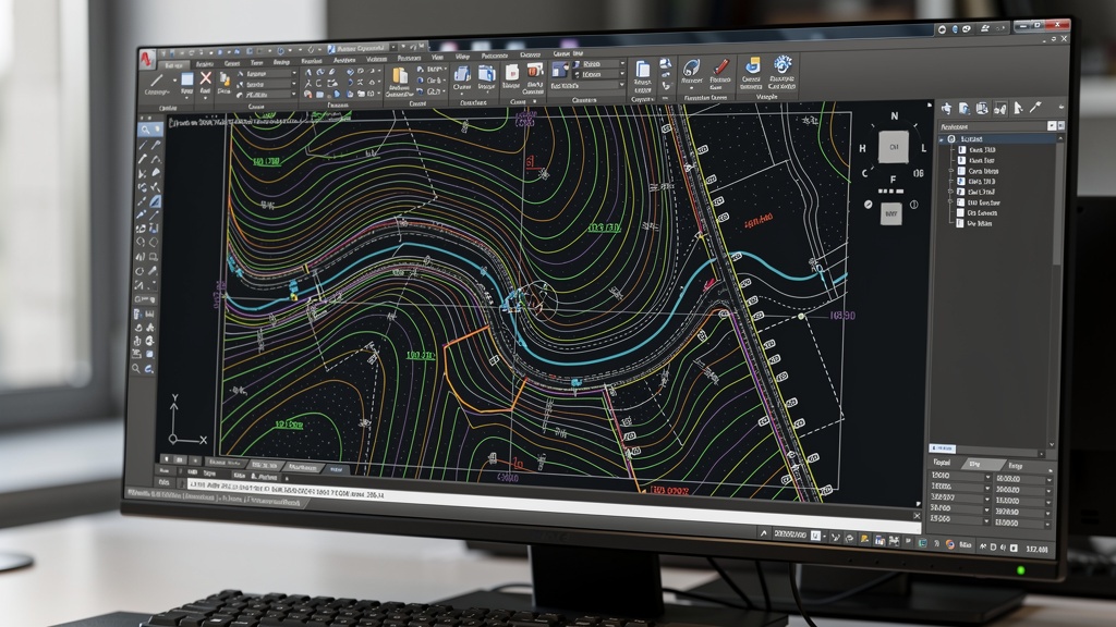
3D Laser Scanning
For larger, more complex buildings — particularly historic buildings, buildings with irregular geometries, or projects requiring a high level of detail — 3D laser scanning is increasingly the preferred method. The scanner captures the complete geometry of every space from multiple positions, producing a point cloud that is processed and converted into CAD drawings or a BIM model in the office.
The advantages of laser scanning for measured building surveys are significant:
- Complete data capture — nothing is missed or approximated
- Faster on site for complex buildings
- Sub-centimetre accuracy throughout
- The point cloud provides a permanent record of the building as-surveyed
- The same data can be used to produce additional drawings or check dimensions retrospectively, without returning to site
Combined Approach
Most real-world measured building surveys use a combination of methods — laser scanning for complex interior spaces and external facades, supplemented by conventional measurement for areas the scanner cannot reach, and GPS for external referencing to OS national grid.

Measured Building Surveys for Listed Buildings
Listed buildings require particular care in survey specification. Heritage England's guidance emphasises the importance of comprehensive, accurate survey records for listed buildings — both for planning purposes and as a permanent heritage record.
For listed building consent applications, planning officers and historic environment record (HER) teams typically require:
- Detailed floor plans, elevations and sections at an appropriate scale (usually 1:50 for detailed areas, 1:100 for overall plans)
- Accurate representation of all significant historic fabric — original features, later alterations, fabric of special interest
- Photographs cross-referenced to the drawn survey
- In some cases, a full 3D laser scan record as part of the heritage documentation
We have worked on listed buildings of all types and grades across the UK, from Grade II listed residential properties to Grade I* scheduled ancient monuments. For heritage projects, we recommend discussing the survey specification with your heritage consultant before commissioning, to ensure the survey fully meets the requirements of the planning authority.
Measured Building Survey vs RICS Building Survey: What's the Difference?
This confusion comes up regularly. The terms sound similar, but they refer to entirely different services:
- A measured building survey is a dimensional record of a building — it captures geometry and layout, referenced to scale. It is produced by a land or building surveyor and is used by design teams.
- A RICS Building Survey (also known as a Level 3 Survey or Full Structural Survey) is a condition assessment — it evaluates the structural condition of a building, identifies defects and recommends remedial works. It is produced by a building surveyor and is used by property buyers.
The two surveys serve completely different purposes. A measured survey does not assess condition; a condition survey does not record dimensions. For many refurbishment projects, you may need both — but they should be commissioned from specialist practitioners in each field.
What Format Will I Receive the Survey In?
All measured building surveys from Surveyor Topographer are delivered as AutoCAD DWG files and PDF plans, at a scale appropriate to the project. Standard delivery formats include:
- DWG — native AutoCAD format, compatible with all major CAD applications
- DXF — for non-AutoCAD systems
- PDF — for review, printing and submission to planning authorities
- RVT / Revit — where a BIM model is required (typically LOD 200–350 as specified)
- Point cloud (LAS, E57, RCP) — where 3D laser scanning is included in the scope
We'll always confirm the delivery format with you when the survey is commissioned, and we're flexible — if your architect or engineer uses a specific software, just let us know.
How Much Does a Measured Building Survey Cost?
Cost depends primarily on the size of the building, the complexity of its layout, the level of detail required and whether 3D laser scanning is included. Indicative costs:
- Small residential property (up to 150m² GIA) — £600–£1,200 + VAT for standard floor plans, elevations and sections
- Medium property or commercial unit (150–500m² GIA) — £1,200–£3,000 + VAT
- Large building (500–2,000m² GIA) — £3,000–£8,000 + VAT, depending on complexity
- 3D laser scanning add-on — typically 40–80% above conventional survey cost, but often more efficient for complex buildings
- BIM model (Revit) — typically adds 30–60% to the drawn survey cost, depending on the LOD
These are indicative figures only. Get in touch for a fixed-price quote for your specific building and project requirements.
FAQ: Measured Building Surveys
For a straightforward loft conversion on a standard house, your architect may be able to produce adequate drawings from their own measurements for planning purposes. However, for more complex houses, older properties with irregular layouts, or projects where building regulations submission needs to be highly accurate, a professional measured survey provides a much more reliable basis for design and avoids costly errors.
Yes — and this is often the most efficient and cost-effective approach for development projects. When both a measured building survey and a topographic survey are required, we can carry them out simultaneously, sharing equipment, site access and control data. The resulting drawings are fully integrated — the building plans are referenced to the same national grid and datum as the site survey, allowing them to be used together seamlessly by the design team.
For a standard residential property, the site work typically takes half a day to a full day, with drawings delivered within five to ten working days. For larger or more complex buildings with laser scanning, site work may take one to three days, with drawings within ten to fifteen working days. We'll confirm the programme in your written quotation.
This is very common for older properties — the original drawings simply no longer exist. A measured building survey produces a complete set of drawings from scratch, based entirely on physical measurement. This is one of the most valuable services we provide — creating an authoritative drawing record for a building where none previously existed.
A measured survey captures only what is visible. Concealed structural elements — steelwork, floor joists, roof trusses within a closed roof void, hidden beams — will be shown as "concealed" or inferred from surface features where possible, but cannot be definitively measured without opening up the fabric of the building. Where concealed structural elements are critical to the project, a structural engineer's investigation (potentially involving trial openings) would be required in addition to the survey.
Related Articles
Need a Measured Building Survey?
Tell us about your building and project. We'll advise on the right survey specification and provide a free, fixed-price quote for your measured building survey.
Get a Free Quote