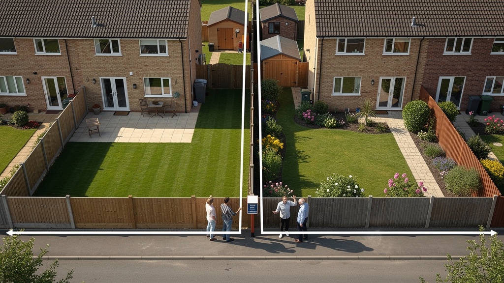
Boundary disputes are among the most stressful — and costly — situations a property owner can face. A fence moved by a few inches, a wall rebuilt in the wrong position, a neighbour's extension that appears to cross the legal boundary — these seemingly minor disagreements can quickly escalate into expensive, time-consuming legal proceedings if they're not handled correctly from the outset.
At Surveyor Topographer, we carry out boundary surveys for homeowners, solicitors, property developers and land registry professionals across the UK every year. In this guide, I want to explain what a boundary survey actually involves, how it differs from a general topographic survey, what evidence it produces, and — critically — how it can help resolve a boundary dispute before it ever reaches a courtroom.
What Is a Boundary Survey?
A boundary survey is a specialist land survey focused specifically on determining the precise position of the legal boundary of a property or land parcel. Unlike a general topographic survey — which captures the broad physical features of a site — a boundary survey is a forensic exercise, combining physical measurement with analysis of title deeds, Land Registry data, historical maps and documentary evidence to establish where the legal boundary lies.
The output is a scaled plan, usually referenced to OS national grid, showing the measured positions of all physical boundary features (fences, walls, hedges, ditches, banks) alongside the surveyor's interpretation of the legal boundary line derived from the title documentation.
It's important to understand that determining a legal boundary is not the same as measuring where a fence happens to be today. Physical features move over time — fences are replaced, walls are rebuilt, hedges grow and are cut back, ground is disturbed. The legal boundary is defined by the original conveyance documents, not by the current position of a fence. A skilled boundary surveyor must be able to reconcile the physical evidence with the documentary evidence — and where these conflict, explain why.
Why Do Boundary Disputes Happen?
Understanding the root causes of boundary disputes helps explain why a professional survey is so often the most effective way to resolve them.
Imprecise Title Documentation
The single most common cause of boundary disputes in England and Wales is imprecise or ambiguous title documentation. Land Registry title plans are based on OS maps and are drawn at scales of 1:500, 1:1250 or 1:2500 — with an implied accuracy of ±1 metre or more at the larger scales. The red boundary line on a Land Registry title plan has a width, when scaled up, that represents several metres on the ground. This is fine as a general registration of ownership, but it is useless for determining the exact position of a boundary to centimetre precision.
Historical Conveyances and Parcels
Many properties — particularly older ones — were conveyed using descriptions like "bounded on the north by the wall of the said property" or "together with the strip of land three feet wide on the eastern boundary." These descriptions were perfectly clear at the time of conveyance, but over decades, walls may have been rebuilt, gardens extended and outbuildings demolished, making the original description impossible to interpret without specialist knowledge.
Development and Subdivision
When land is subdivided and sold off in parcels — as happens with housing developments, farm sales and estate disposals — the boundaries of the individual parcels need to be precisely plotted and registered. Errors in the original subdivision plan can cause boundary discrepancies that persist for decades.
Physical Changes Over Time
Fences, walls and hedges — the physical markers of boundaries — change over time. A fence installed by a previous owner may not have been placed on the legal boundary. A garden wall may have been rebuilt in a slightly different position. A hedge may have been removed and replaced. Without documentary evidence of the original boundary position, determining where the legal boundary actually lies can be genuinely complex.
What Does a Boundary Survey Involve?
A professional boundary survey has three distinct phases:
Phase 1: Documentary Research
Before any measurement takes place, the surveyor examines all available documentary evidence. This typically includes:
- Land Registry title plans and registers — for both properties affected by the dispute
- Original conveyance deeds — pre-dating Land Registry registration, where available; these often contain more precise descriptions than the title plan
- Historical OS maps — at various scales and dates, to understand how the boundary has been depicted over time
- Planning drawings and building regulation documents — which may show the boundary position at the time of a development
- Aerial photographs — historical imagery from Google Earth, the National Collection of Aerial Photography (NCAP) and other sources, showing the evolution of physical features over time
- Previous survey reports — any earlier boundary surveys or measured drawings that may be relevant
Phase 2: Physical Measurement
The surveyor then visits the site to carry out a precise measured survey of all physical boundary features and their relationship to neighbouring features and OS mapping. This includes:
- Precise GPS and total station measurement of all boundary features — fences, walls, gates, hedges, ditches, banks
- Physical examination of any boundary features for evidence of their age, material and construction
- Identification of any "T" marks, party wall markers or other boundary indicators in physical fabric
- Measurement and photography of any encroachments, displaced features or areas of dispute
- Reference to OS control points to ensure the survey is correctly positioned in the national grid
Phase 3: Analysis and Reporting
The surveyor then reconciles the physical evidence with the documentary evidence to reach a professional opinion on the position of the legal boundary. The deliverable is a written report supported by a scaled plan, showing:
- The measured positions of all physical boundary features
- The surveyor's interpretation of the legal boundary, derived from title documentation
- Any discrepancies between the physical and documentary evidence, with an explanation
- The surveyor's professional opinion on the position of the boundary, with reasoning
How Does a Boundary Survey Help Resolve a Dispute?
In many cases, a professional boundary survey resolves the dispute without any legal proceedings at all. Here's how:
Providing Objective Evidence
Many boundary disputes are sustained by a genuine difference in the parties' understanding of where the boundary is. When an independent professional surveyor produces a plan and report showing clearly where the legal boundary lies — supported by measured evidence and documentary analysis — one or both parties often accepts the finding. The emotional element of the dispute is depersonalised, replaced by objective professional evidence.
Supporting Mediation
Where both parties are willing to resolve the dispute but unable to agree on the boundary position, a boundary survey provides the factual basis for mediation. A mediator working with accurate survey data and a professional report is in a much stronger position to facilitate agreement than one working with vague claims and disputed measurements.
Supporting Legal Proceedings
Where a dispute cannot be resolved without legal proceedings, the boundary survey report becomes a key piece of evidence. Expert witness reports from qualified land surveyors carry significant weight in the First-tier Tribunal (Property Chamber) and in civil court proceedings. A professionally produced survey report — clearly reasoned, well-evidenced and impartially presented — can be decisive.
The Difference Between a Boundary Survey and a General Topo Survey
Clients sometimes ask whether a general topographic survey will serve the same purpose as a boundary survey. In most cases, the answer is no — and here's why:
- A topographic survey captures the physical features of a site in plan form. It records where things are, but it does not interpret the legal significance of what it finds.
- A boundary survey goes further: it analyses the documentary evidence, reconciles it with the physical evidence, and produces a professional opinion on the legal boundary position. This is a specialist skill that goes beyond general surveying.
- A boundary survey report can be used as expert evidence in legal proceedings; a general topographic survey plan generally cannot.
That said, a topographic survey is often an essential component of a boundary survey — the physical measurement phase of the boundary survey uses the same techniques and equipment as a topographic survey. The difference lies in the analysis and interpretation that follows.

What About Land Registry Boundary Disputes?
In England and Wales, the Land Registry holds title plans for registered land — but (crucially) the Land Registry does not determine the exact position of boundaries. The Land Registry's general boundary rule means that the red line on a title plan is indicative only, and does not define the legal boundary to precise measurement.
Where a boundary dispute involves conflicting Land Registry title plans — which happens when two adjoining title plans overlap — the correct procedure is to apply to the Land Registry for a determined boundary. This is a formal process by which the Land Registry makes a definitive record of the exact legal boundary, usually requiring a detailed boundary survey report as supporting evidence.
We work regularly with solicitors and their clients on Land Registry determined boundary applications. The process requires a survey to a specific specification, and the report must be prepared to the standard required by the Land Registration Rules 2003.
Tips for Handling a Boundary Dispute
If you're facing a boundary dispute, here's some practical advice from our experience:
- Don't make physical changes to the boundary before taking advice — removing a fence, demolishing a wall or planting a hedge on disputed ground can prejudice your legal position and may constitute a civil wrong
- Gather your documentary evidence first — locate your title deeds, Land Registry title plan and any conveyance documents you have. Your solicitor can obtain these if you don't have them.
- Seek early professional advice — both from a solicitor experienced in boundary law and from a specialist boundary surveyor. The earlier you take professional advice, the more options you have.
- Consider mediation before litigation — boundary disputes that go to court are expensive for both parties. Mediation, backed by survey evidence, resolves the majority of disputes without litigation.
- Keep records of all communications — document all conversations with your neighbour about the boundary, and confirm any discussions in writing.
How Long Does a Boundary Survey Take?
For a standard residential boundary dispute, the documentary research and site survey can typically be completed within one to two weeks, with the written report delivered within a further week. More complex cases — involving multiple parcels, extensive historical documentation or expert witness requirements — may take longer.
If you have a legal deadline (for example, a court hearing date or a Land Registry application deadline), let us know when you make your enquiry and we'll do our best to meet it.
FAQ: Boundary Surveys and Disputes
There is no fixed rule — in practice, whoever commissions the survey pays for it initially. Where a dispute is ultimately resolved in your favour (by mediation, court order or Land Registry determination), you may be able to recover survey costs from the other party, but this is not guaranteed. Joint instruction of a single surveyor by both parties — sometimes called a Single Joint Expert — can reduce costs and is often a more efficient approach in lower-value disputes.
The Land Registry cannot adjudicate on boundary disputes, but it does have a process for "determining" a boundary — making a precise record of the boundary position on the title plan. This requires a survey report prepared to Land Registry specification. Where the other party disputes the determined boundary application, the matter may be referred to the First-tier Tribunal (Property Chamber) for a binding decision.
Adverse possession (sometimes called "squatter's rights") is a legal mechanism by which a person who has occupied land without the owner's permission for a sufficient period of time (10 years for registered land, 12 years for unregistered land) may be able to claim legal title to it. Boundary surveys often uncover adverse possession situations — where a fence has been in a position that encroaches on a neighbour's land for many years. Your solicitor can advise on whether adverse possession is relevant in your specific situation.
Land Registry title plans are drawn at scales of 1:500, 1:1250 or 1:2500, depending on the area. At 1:1250 scale (typical for urban residential properties), a 1mm line on the plan represents 1.25 metres on the ground. This means the boundary line on a title plan has an inherent imprecision of several metres — it is intended as a general indication of ownership, not a precise measurement. For precise boundary determination, a site-specific survey referenced to OS national grid is always required.
Yes. A boundary survey report prepared by a qualified and experienced land surveyor can be submitted as expert evidence in the First-tier Tribunal (Property Chamber) or in civil court proceedings. For the report to be admissible and persuasive, it must comply with the relevant court rules on expert evidence — including a statement that the expert's duty is to the court, not to the instructing party. We prepare reports in accordance with these requirements when specifically instructed to do so.
A "general boundary" is the standard form of boundary recorded in the Land Register — it shows the approximate position of the boundary but does not define it precisely. A "determined boundary" is a more precise record made following a formal application to the Land Registry, supported by a detailed survey. Once a determined boundary is registered, it is legally definitive — and can only be challenged in exceptional circumstances. Determined boundaries are relatively rare but are increasingly used to resolve disputes once and for all.
Related Articles
Facing a Boundary Dispute?
Our specialist boundary survey team is here to help. Get in touch for a free initial consultation and fixed-price quote.
Get a Free Quote